Augmented Reality (AR) is reshaping urban planning by making zoning, property research, and public engagement faster and more accessible. Here's how AR is driving change:
- Public Engagement: AR increases public participation in planning by 45%, making zoning rules and designs easier to understand through interactive 3D models.
- Efficiency: Tools like Plotzy combine AR with AI to simplify zoning analysis, property research, and compliance checks, cutting project approval times significantly.
- Visualization: AR overlays digital models onto real-world spaces, allowing stakeholders to experience projects before construction begins.
- Collaboration: AR fosters teamwork by enabling real-time updates, remote collaboration, and instant feedback during urban planning sessions.
- Impact Analysis: AR helps planners assess environmental, traffic, and architectural impacts, ensuring smarter, more informed decisions.
AR isn't just a tool - it's changing how cities are planned, making the process more interactive, efficient, and inclusive.
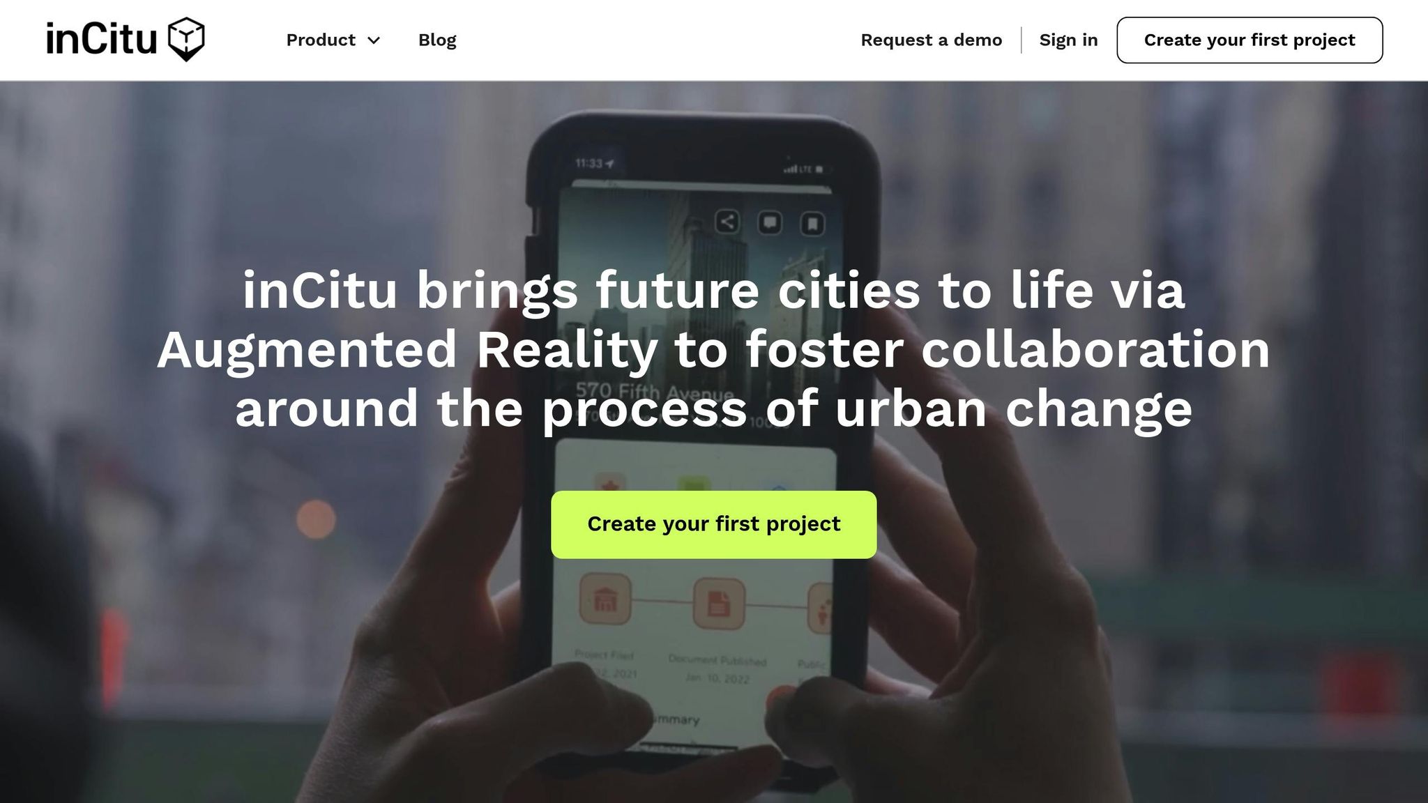
AR in Urban Planning W/ Dana Chermesh-Reshef, founder of inCitu - Building The Open Metaverse
AR for Urban Project Visualization
Augmented reality (AR) is reshaping how urban planning projects are visualized and communicated. By overlaying digital models onto real-world settings, AR gives stakeholders a chance to experience proposed developments long before construction begins.
Creating 3D Urban Models
Developing 3D urban models for AR requires a high degree of technical precision. Researchers have devised methods to convert 2D designs into 3D models suitable for AR applications.
To ensure these models perform well in AR environments, optimization is key. Here are some critical areas to focus on:
| Optimization Element | Strategy |
|---|---|
| Geometry | Minimize polygon count without sacrificing visual clarity |
| Textures | Use compressed formats and resolutions tailored for AR |
| Materials | Limit the variety of materials and shaders used |
| Animation | Implement efficient skeletal rigging and compression techniques |
"Models developed in 3D accurately convey spatial information and how objects are located in the 3D space in relation to real-world objects."
These technical steps lay the groundwork for AR applications like zoning visualization, making them both functional and effective.
Viewing Zoning Rules in AR
Once accurate 3D models are in place, AR can turn static zoning data into interactive, 3D visualizations. A great example of this is "BorderGO", a prototype developed by NorKart and the Norwegian Mapping Authority in Oslo. This tool uses smartphone AR to display property boundaries in real time, adding a new layer of insight for planners.
AR allows urban planners to assess designs on-site, detect potential conflicts early, and compare different scenarios. It also opens up new ways to engage communities, making complex zoning data more accessible.
"Public processes can be so burdensome and time-consuming, and it often amplifies the loudest, most negative voices in the room. If there's a way to alter that public engagement to help people collaboratively visualize change in their communities, that technology could alter the conversation from 'yes or no' to an opportunity for constructive dialogue. We hope to facilitate effective communication without technological barriers to participation." - Marc Schlossberg, Professor of City and Regional Planning, University of Oregon
A standout example of AR's potential comes from Eugene, Oregon. In 2024, the University of Oregon teamed up with city planners to reimagine the streets near the Oakway shopping center. Recent graduate Luke Walker worked on translating design concepts into AR, focusing on safer cycling infrastructure and speed regulation through thoughtful design.
Steps to Use AR in Urban Planning
Setting Up Project Data
To effectively use AR in urban planning, start by combining multiple data sources like geographical, zoning, and environmental data into a unified platform. Modern GIS tools make this process easier by linking geographical features with location-specific information, helping to uncover essential patterns and relationships.
Here’s how the key data components come together:
| Data Type | Description | Purpose |
|---|---|---|
| Geographical Data | Topographical maps, satellite images, street layouts | Forms the foundational environment for AR overlays |
| Zoning Information | Building height limits, parcel coverage, permitted uses | Establishes development boundaries |
| Environmental Data | Climate trends, soil conditions, drainage systems | Guides planning for long-term sustainability |
Once the data is organized, the next step is to create accurate AR models.
Building AR Models
Developing AR models requires both technical precision and user accessibility. Tools like Google’s ARCore Geospatial API, introduced in 2022, have taken AR modeling to the next level by offering real-time positioning services. These capabilities have already been applied in commercial settings, such as Lyft’s navigation services, and have paved the way for creating location-specific AR experiences.
Key priorities when building AR models include:
- Platform Compatibility: Ensure models function seamlessly across devices, from smartphones to AR glasses.
- Real-Time Integration: Incorporate live data streams for continuous updates.
- User-Friendly Interfaces: Design intuitive tools that allow users to easily adjust urban planning elements.
Once models are built, they need to be tested in real-world settings.
Testing Models On-Site
Field testing is crucial to ensure the AR models and integrated data improve urban planning in practical scenarios. Studies show that interactive AR displays can enhance stakeholder engagement by 75%.
When testing, focus on:
- Environmental Conditions: Check how the system performs under different lighting and weather scenarios.
- User Interaction: Test navigation features and control responsiveness.
- Technical Performance: Monitor factors like battery usage, system stability, and location accuracy.
Testing should cover a variety of environments, from bright outdoor spaces to complex urban landscapes, to ensure the system works reliably. Research indicates that using real-time data in AR applications can boost operational efficiency by as much as 70%.
AR Tools for Team Collaboration
AR's strengths in visualization now extend to fostering collaboration, allowing teams and communities to work together seamlessly on urban projects. This technology has reshaped how urban planning teams operate, breaking down communication barriers and enabling real-time teamwork. Studies indicate that AR tools not only speed up the design iteration process but also significantly reduce the chances of miscommunication among stakeholders.
Public Feedback with AR
AR bridges the gap between complex urban planning concepts and public understanding, making it easier for communities to engage with large-scale projects. A notable example is the "Stadt Mitt am Fluss" project in Saarbrucken, Germany. This initiative introduced a "smart walk" system with nine interactive stations, enabling residents to visualize neighborhood transformations without requiring technical expertise. Features included:
- Virtual models of proposed changes
- Real-time platforms for sharing opinions
- Remote access to project visualizations
Here are a few recent examples showcasing AR's impact in public engagement:
| Project | Location | Impact |
|---|---|---|
| DignityMoves | California | Used Google's Geospatial Creator to present supportive housing designs |
| LinkUS Initiative | Columbus, Ohio | Offered an on-bus AR experience to visualize transit network plans |
| Frank D. Reeves Center | Washington, D.C. | Allowed the public to view 3D redevelopment plans in detail |
Developer-Architect Planning
AR isn't just for public engagement - it also transforms collaboration between developers and architects. By creating shared virtual workspaces, AR enables team members to interact with urban plans in real time, making adjustments and refining designs collaboratively. In November 2024, researchers at the University of Oregon showcased this potential with a $50,000 research initiative that developed customizable AR tools for street redesign.
Key benefits of AR for professional collaboration include:
- Real-time Visualization: Teams can make immediate design updates during meetings.
- Remote Collaboration: Stakeholders can join planning sessions from anywhere.
- Instant Feedback: Designs can be evaluated and adjusted on the spot.
- Error Detection: Potential issues are identified early, reducing costly mistakes.
Mishingo Kirsten Sithelo, a Principal Urban Planner, highlights the power of AR in communication:
"One thing I find helpful with visual communication is the ability to transmit message faster, vividly demonstrate scenarios and convey solutions. It simply facilitates understanding and easy processing of text based information hence boosting engagement."
AR tools are especially valuable for complex urban projects involving multiple stakeholders. By layering different aspects of urban planning - such as infrastructure and zoning - AR provides a comprehensive perspective that improves decision-making and streamlines collaboration.
sbb-itb-11d231f
AR for Project Approval and Rules
Augmented Reality (AR) is reshaping how urban projects are reviewed and approved. By streamlining zoning checks and site impact assessments, AR speeds up approval processes while ensuring compliance with municipal regulations.
Checking Zoning Rules Live
AR makes zoning verification faster and more precise by overlaying digital models directly onto physical sites to identify potential violations. For example, the BRISE-Vienna research project has developed 12 AR-based use cases specifically aimed at helping public authorities reduce processing times and improve project comprehension. This system integrates Building Information Modeling (BIM) for on-site plan verification, provides instant access to zoning codes, and conducts real-time architectural checks. In Vienna, where traditional project approvals can drag on for up to 18 months, AR has significantly cut down review times while ensuring all regulatory requirements are met.
Testing Site Impact
Beyond zoning, AR refines project planning by enabling detailed site impact analyses. Planners can visualize how a development will affect its surroundings before any construction begins. Some key applications include:
| Assessment Type | AR Visualization Features | Benefits |
|---|---|---|
| Environmental Impact | Sunlight patterns, shadow casting | Protects nearby properties |
| Infrastructure Load | Traffic flow simulation, utility routing | Encourages efficient planning |
| Architectural Integration | Real-scale virtual prototypes | Ensures design compatibility |
| Structural Alignment | Digital overlays on construction sites | Identifies potential issues early |
Santosh Kumar Bhoda, an expert in geospatial technology, highlights the value of AR in project validation:
"AR enhances design validation by overlaying digital models onto the physical construction site... This overlay helps detect misalignments and inconsistencies between the design and the built environment."
Additionally, AR's ability to create spatial representations of proposed projects makes it easier for non-experts to grasp complex designs. This fosters more informed public consultations, encouraging smoother discussions and quicker consensus during the approval process.
Conclusion
Augmented Reality (AR) is reshaping urban planning by enabling more informed and inclusive decision-making. Real-world examples, like Queensland's rail project and Charleston's barrier visualization, highlight how AR enhances stakeholder engagement and brings complex ideas to life. When paired with AI tools like Plotzy, AR makes zoning compliance and property analysis more efficient and accessible.
"Good urban planning reflects a community's values through its built environment, a human-centered process AI cannot replace. However, AI enhances planning by modeling future spaces and analyzing costs with speed and precision. It brings predictability to real estate development while preserving the vital role of human insight. As a tool, AI complements planners, enabling them to shape spaces that truly serve their communities."
The future of urban planning may also see zoning laws evolve to support mixed-use developments. A great example is the Steel Tech redevelopment in Jersey City, where a 3.3-acre brownfield site is being transformed into a dynamic urban space. These initiatives demonstrate how AR can foster community engagement and inspire innovative planning.
AR's immersive nature has proven invaluable for engaging stakeholders effectively. Take the Virtual City project in Uppsala, Sweden - over four years, it shifted discussions from technical details to meaningful conversations about urban integration. This underscores AR's power to promote transparency, collaboration, and efficiency in shaping the cities of tomorrow.
FAQs
How does Augmented Reality enhance community involvement in urban planning?
Augmented Reality (AR) and Community Involvement
Augmented Reality (AR) is reshaping the way communities engage with urban planning by turning complex concepts into immersive, easy-to-grasp visual experiences. With AR, residents can see proposed developments come to life in real-time, offering a clear picture of how changes might affect their neighborhoods - whether it’s adjustments to traffic patterns, updates to public spaces, or shifts in overall design.
This technology also opens the door for ongoing conversations between planners and the community. It encourages feedback and collaboration, making the entire process more inclusive. By simplifying urban planning and making it more interactive, AR helps ensure that projects reflect the needs and priorities of the people who live there, resulting in outcomes that are both practical and widely supported.
What are the most important technical factors for creating 3D models for AR in urban planning?
Creating 3D models for augmented reality in urban planning demands attention to several critical elements. First, geometry accuracy is vital. Models need to strike a balance between being detailed enough for clear visualization and optimized enough to maintain performance. Techniques like adjusting the level of detail (LOD) can help manage polygon counts effectively.
Equally important are high-quality textures. Realistic and well-mapped textures not only make the models visually appealing but also improve their overall usability. However, these textures must also be optimized to support real-time rendering, ensuring smooth performance without lag or interruptions.
Lastly, spatial accuracy and AR platform compatibility are non-negotiable. Models should reflect real-world dimensions precisely and work seamlessly with AR tools, allowing for intuitive interaction and better decision-making in urban planning scenarios.
How does augmented reality improve collaboration in urban planning projects?
Augmented reality (AR) is transforming collaboration in urban planning by giving planners, developers, and architects the ability to interact with detailed 3D models in real-time. With AR, teams can place proposed designs into the context of their actual surroundings, making it easier to communicate ideas, avoid misunderstandings, and make smarter decisions.
This technology also simplifies tricky tasks, like overlaying zoning rules or environmental data directly onto physical maps. It ensures accuracy and helps teams stay compliant. Beyond that, AR opens the door for greater community involvement. Residents and stakeholders can see visual representations of projects and share their input, making the planning process more open and participatory. The result? Better project outcomes and stronger community backing for urban development.